Sheep Mountain Trail, Centennial, WY
The information in this piece may be out of date. I have moved away from Cheyenne and am no longer maintaining this site. You may leave a comment if you wish. Useful comments will continue to be posted.
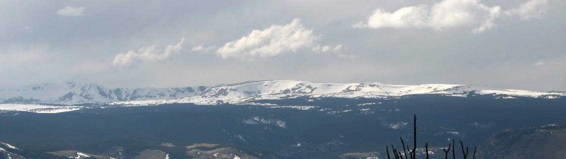
Highlights: This is the mountain that everyone sees but few explore, the eastern most spur of the Medicine Bow Range. From the road the mountain simply looks like a narrow ridge. But don’t judge a book by its cover. The mountain top is a big surprise, a long basin with flowing streams, abundant wetlands and floating mat bogs. The 19,238 acres of Sheep Mountain were designated a National Wildlife Refuge on August 8, 1924 to preserve our elk population. It is roadless and the trail is the longest hiking trail on the Wyoming side of the Medicine Bow range. Mountain bikes are allowed.
Location: West of Laramie, southeast of Centennial.
Elevations: Sheep Mountain trailhead (south) 7840’, high point 9480’, north access route 7700’.
Distance: Roughly 15 miles from end to end.
Maps: USGS Rex Lake (north), Lake Owen (south); Medicine Bow National Forest Map, Medicine Bow “Sheep Mountain” pamphlet.
Guide:
Marc Smith’s Hiking Wyoming’s Medicine Bow National Forest – Third Edition, Erik Molvar’s Wild Wyoming
.
The Just Trails website has some good photos and maps to copy or gps trail beta to download. Check out: http://www.justtrails.com/trails/sheep-mountain/
Trailhead: From Cheyenne take I-80 to Laramie, Exit 311, go southwest on WY 230 for 23 miles, turn north on Fox Creek Road (Forest Service 311). There are two southern trailheads: Sheep Mountain Trailhead at 2.3 miles and the Forbes Game and Fish Trailhead at 5.5 miles. The Forbes trail is closed between January 1st and April 30th to protect elk calving. The North access, which only the crazy or the seriously athletic would want to ascend, begins at a small pull out with on WY 11, 1.9 miles south of WY 130. There is a simple wire gate and a post where the sign used to me. (See photo at end.)
The Forest Service’s Sheep Mountain pamphlet shows a Fence Creek Access as well. The Fence Creek trail does not join the main Sheep Mountain Trail. It goes through an area that was heavily burned during the Squirrel Creek fire of July 2012. Few people will wish to explore this now difficult route.
The hike:From the Sheep Mountain Trailhead (Trail 386) your hike skirts a stand of trees and then moves into a dry open sagebrush hillside, busy with wildflowers in the spring. You’ll cross a two track and some underground piping. Keep your eyes out for posts marking the trail. It can be a hot climb, but it doesn’t last long. After the first mile it levels out for another one mile, and then climbs steeply into the refreshing shade of lodgepole pines. But before entering the dark forest, get a good view of the Snowy Range and the Laramie Plain. They’ll be hidden away in this high sanctuary. The trail levels out for miles of walking among the trees, along the sides of bogs and the trickling headwaters of streamlets.
Sadly this trail receives only sporadic maintenance. On a May, 2017, day trip I found a large area of deadfall just past an irrigation headgate. Climbing over and around this mass of fallen trees and relocating the trail can be a challenge. I understand from Shan Holyoak who went up earlier in 2017 that the trail is generally clear after that point until it nears the end. Then more deadfall makes travel difficult.
The Forbes Wildlife trail (Trail 386W) offers somewhat different views as it ascends the sagebrush slopes to join 386. There is no sign at that mountain top junction. You may want to create a temporary marker of sorts so you recognize your return route.
The mountain is an uplift of ancient Precambrian granite, the same pink, coarse grained Sherman type rock we’re familiar with from Pole Mountain. At the north end though, the rock changes, showing an even older, darker granite and hornblende gneiss. There is a high point of marble off the trail to the west.
Most hikers will make a day of Sheep Mountain, turning back when dinner calls. A few will want to cover the whole 15 miles with a friend, making a route down the plunging sides of the steep draws, 1700 vertical feet to a stashed car. I lost the trail on a high, narrow ridge and used a GPS to find my way down. If you’re going to do it, stay above all fences to avoid trespassing on private property.
On one trek I met up with a father and son making an overnight backpack trip of the mountain. As I rushed to get off the trail by dark I envied them. There are a number of nice campsites on top, established by hunters. If you’re camping please use established fire rings. From the north end you can see the Snowy Range, Rocky Mountain National Park and the peaks of the Rawah Wilderness. Such a tranquil place so close to home.
Pointers: While in the open sage keep your eyes out for the Colorado Tansy-aster (Machaeranthera Coloradoensis), a pink, rose or purple ray flower with golden centers, sprouting from a grayish white herb with coarsely toothed leaves. It’s considered a sensitive species, imperiled due to its rarity.
Do you have a GPS? I placed a geocache at N 41 15.557’, W 106 02.699’. Good luck! It’s at elevation 9,445’. When you find it, log in, take a trinket and leave a trinket.
The bogs are interesting and picturesque. They are also prime breeding ground for mosquitoes, which can be fierce near sunset. I noticed that some campsites have been made on hill tops to catch a breeze, hopefully strong enough to keep the weak flyers grounded. Don’t forget repellent, whether coming day or night. Ticks can be plentiful in spring as well.

Comments
Charles Logsdon
Jan 22, 2011
I hiked this trail in 1988. It was, indeed, great to get away from graduate school at Univ.Wyo. and “head for the hills,” as it were. I haven’t been back to Sheep Mountain since (passed it by on Wyo. 130 and 230 a number of times, but didn’t get back to that amazing crest. Good to see this site. Great job describing the trail, although it has changed a bit since my tour.
“Thanks for the memories”
Charles Logsdon
JD SHORT
Mar 12, 2024
1970’S I WOULD RIDE MY MULE UP ON TOP THEN ACCROSS THE TOP TO ROAD THAT CROSSED TO EAST SIDE I LIVED AT THE EVERS BY HIGHWAY 130
stanley polley
Nov 10, 2012
I have a cache up there too (Northern Trailhead)… a gorgeous spot that i’m planning to ascend tomorrow morning (in the snow/cold) to snag a FTF…. 🙂
Roger Ludwig
Jun 24, 2017
All, I hiked Sheep Mtn last Monday/Tuesday south to north. Made it a pretty easy overnighter. But, what I want to tell you all about is that I discovered a trail that descends most of the way down to the access point off of hwy 11.
On an earlier excursion I had found a nice fire ring with a trail next to it. I have always suspected that hunters probably use the campsite as well as the trail. So I made it a point to go to that area and follow the well-defined trail.
I followed it down almost to the north/south running game trails that lead to the access point. It fizzles out a couple hundred yards from them but I’m sure this is as the riders approach that area they just take shortest/easiest route. My off-trail route up the mountain basically was always a bit south of the trail. My logic was to stay out of the trees for easier hiking. Had I wandered a bit more north and up into the trees I would have stumbled across the trail.
Coming from the access point you follow the well-defined track that runs easterly then curve to the south as the trail does. You will pass, on your right, a heavily vegetated area. Then just a bit further south, on the east side, there is a double trunked tree next to another tree. These trees are just to the left of a very tiny drainage. Staying on the left of the drainage follow it up 100 yards or so. Slightly veer to the north and follow disturbed earth until you reach a small knob. This section is pretty steep and probably a few hundred yards. Once you get to the knob the trail becomes defined and will take you right up to the ridgeline.
I will attach a photo or two to show you the trees that are the reference point.
Shan
Doug Baker
Aug 5, 2019
Hi Roger,
Just did the north trailhead access yesterday, using your photo of the unmarked trailhead gate and description of how to pick up the main trail. Worked very well!
I did lose the trail a few times on top, but always got back to it by using the “stick to the ridge” philosophy.
Thanks for sharing your experiences!
Doug
Dave
Jul 4, 2022
How’s the water situation north of the wetlands? Was thinking if making an overnight south to north and wondering if i need to carry enough or if i can plan to fill up. Thnx
Roger Ludwig
Oct 6, 2022
Sorry it has taken me so long to reply. There is usually plenty of water until you get completely to the north end. If you took your trip, what did you find?