Hidden Secrets of Vedauwoo and Pole Mountain, Part 2
The information in this piece may be out of date. I have moved away from Cheyenne and am no longer maintaining this site. You may leave a comment if you wish. Useful comments will continue to be posted.
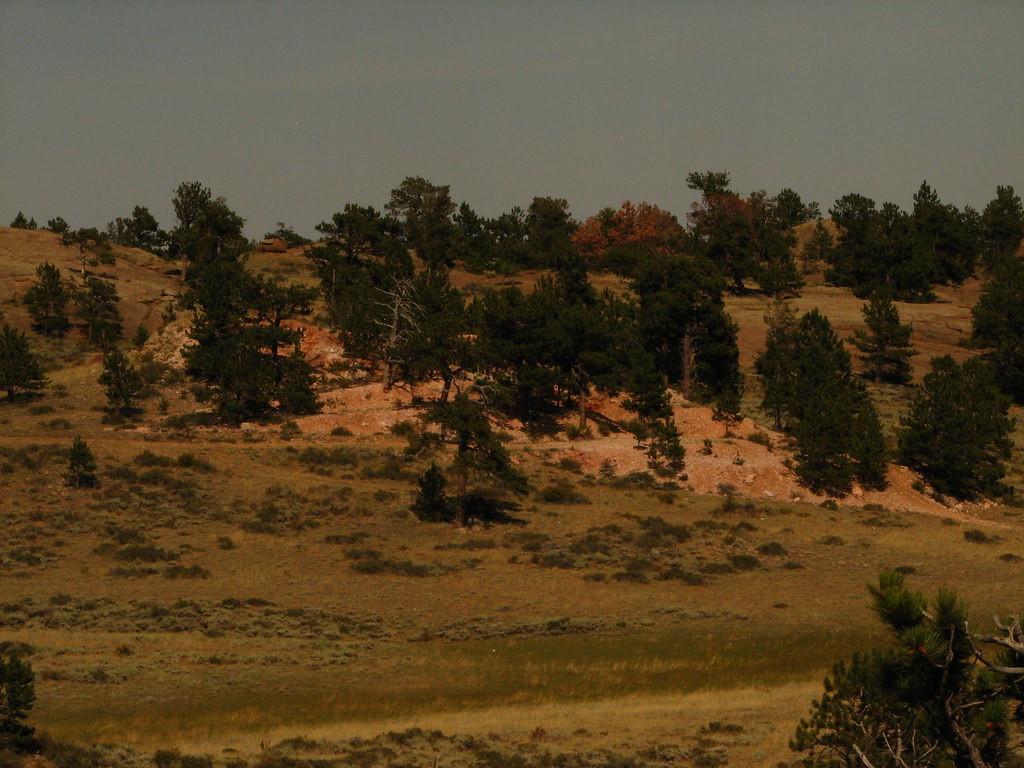
The Pole Mountain area, now a scene of play and renewal, has a history of struggle and tumult. For decades warriors trained, grunted and groused; “readied, aimed and fired“, detonating explosives that tore the quite high country air. Civilian Conservation Corpsmen sweat and labored, building roads and planting the forest we enjoy today. Miners blasted the rocky knobs of quartz for uranium, trucking it off in growling low gear.
Considering all this activity it is surprising how rare are the remains. Frankly the military and the forest service have done a thorough cleaning up. But they missed a few things.
Last year we published a treasure hunt of the “Weird and Wonderful”. For those who enjoyed it, here’s a new quest for even more subtle relics.
While discovering these sites please remember to preserve them in every way, leaving every rock and stick in place. I’m trusting you. Most of these are especially fragile. And by all means don’t dig. Unexploded munitions could render you the last casualty of WWII.
UTM refers to Universal Transverse Meridian, designating a way point to be used with a GPS or a USGS topo map. (1927 Datum.)
Two collapsed earthen observation bunkers far to the northwest.
FS 701 north. Left on 712. Right on 702. Left on 714. Right on 715. Open the gate, continuing on 715. They are at a high point on the grassy hill just off 715 on the left, pointed at Eagle Rock. Image laying in one of these as shells whistle overhead, your field glasses trained on the clouds of dust and smoke that note impact, radioing the results back to the big guns. (UTM 0465300 / 4571836)
One collapsed earth and rock bunker overlooking Eagle Rock.
FS 701 north. Left on 712. Right on 702. Right on 714. On the south side of the road at the high point of the ridge. A limber pine now grows from the south end. (UTM 0470062 / 4569441)
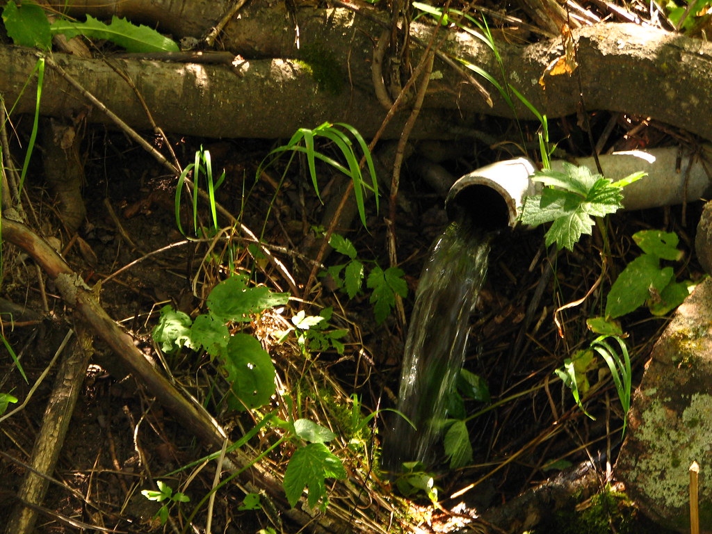
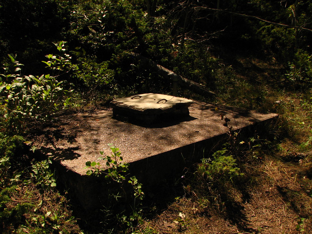
Artillery Spring.
Here is a refreshing spigot of cool, clear, ever-flowing water. From Happy Jack, go north on FS 701 parking just before South Lodgepole Creek. Walk west along the south side of the creek until you can follow an old overgrown road cut into the aspens into the second draw. As you enter the trees about a tenth mile from FS 701 listen for the sound of water. Above the pipe is a large concrete collecting tank with lid. (UTM 0469987 / 4567334)
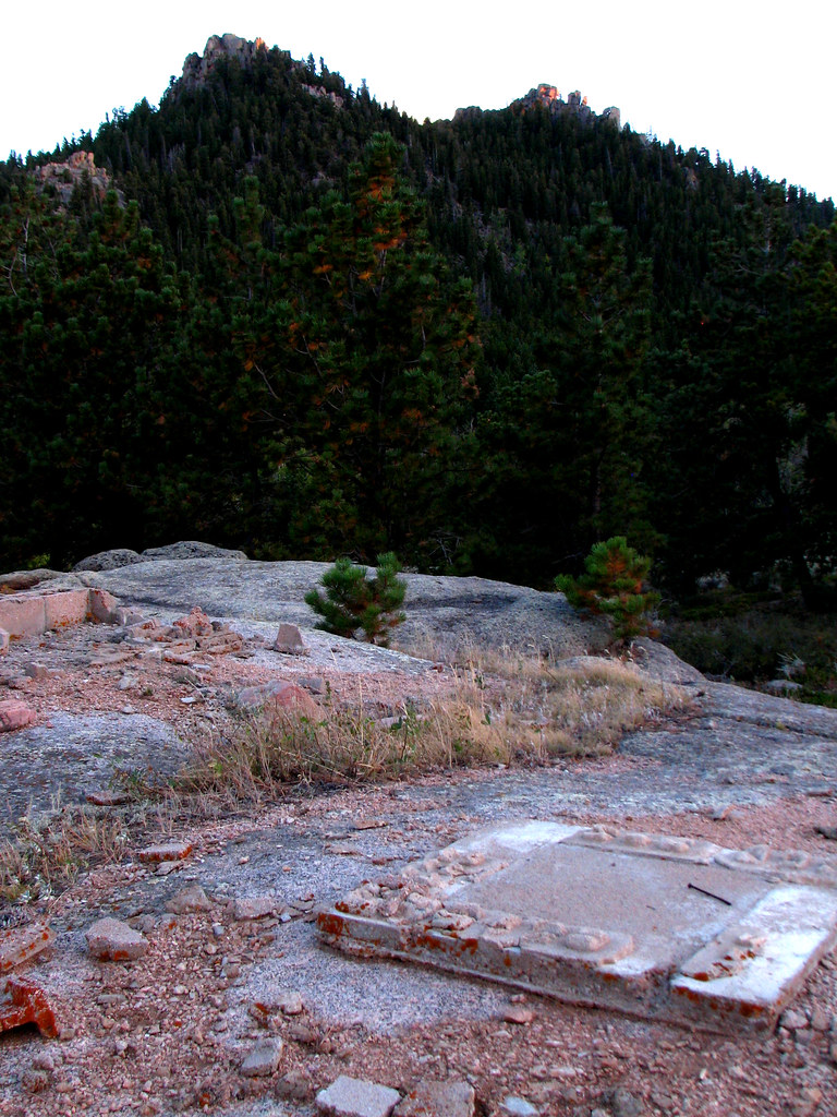
Unknown construction and overlook.
High above the old military headquarters is a prominent point. Just behind the top are the remains of some little building or privy. While the archeology is minimal the view is maximal. From here one can overlook the HQ and it’s fading roads, the Snowy Range, Rawah Peaks, the Mummy Range in Rocky Mountain National Park and Twin Mountain and Turtle Rock nearby. From Happy Jack go south on FS 707, parking at the Headquarters Trailhead. Hike up the trail. When you’ve reached the junction with the Browns Landing trail leave the trail and make your way up to the near highpoint on your right. (UTM 0467163 / 4563686)
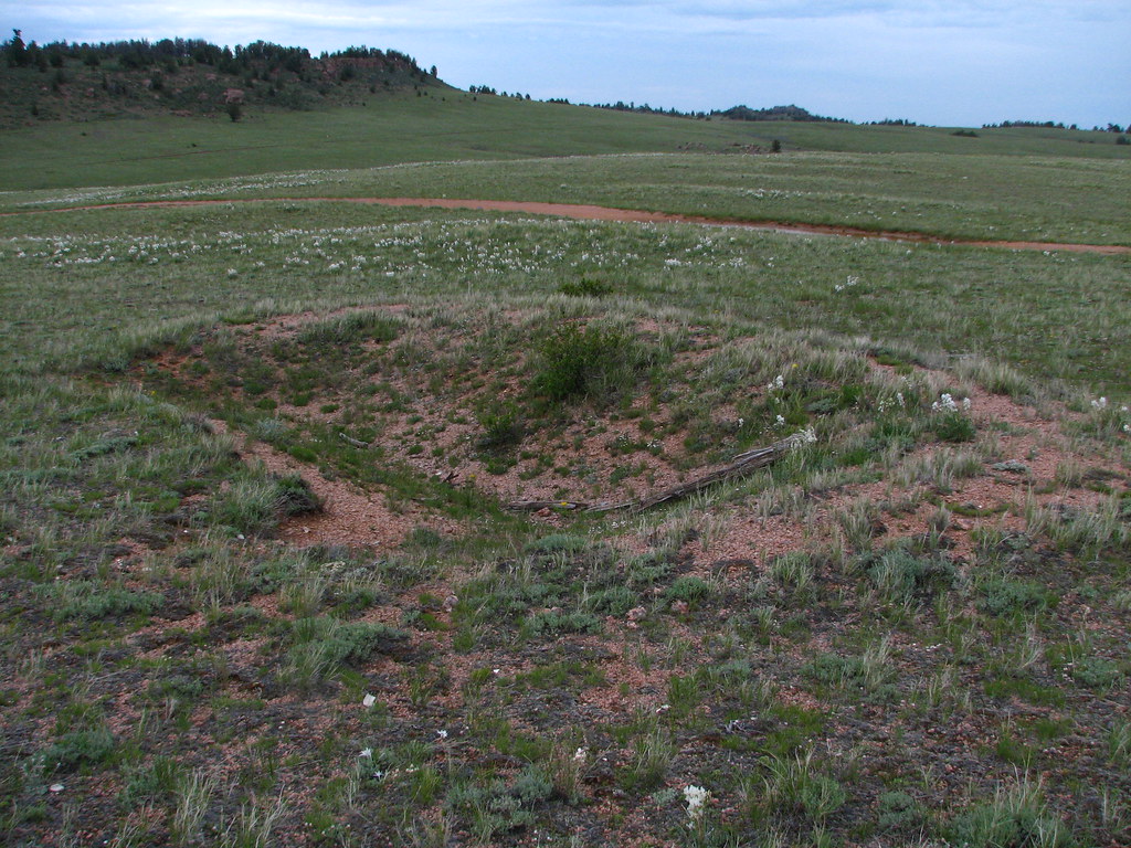
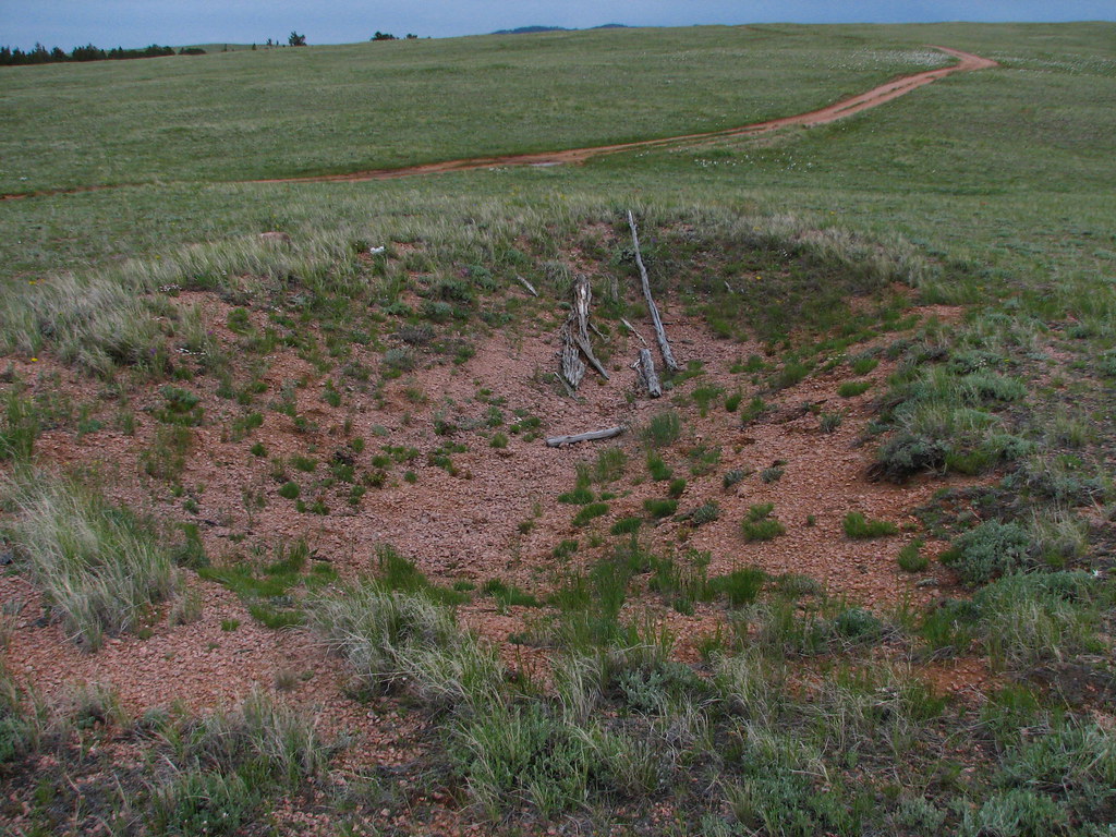
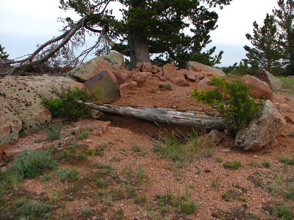
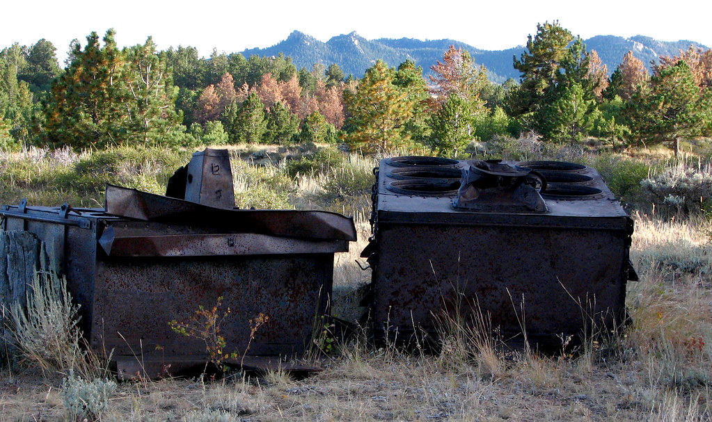
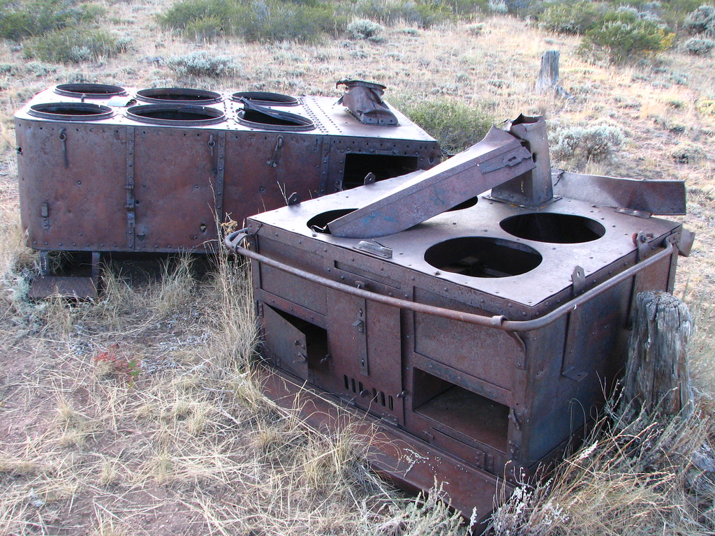
Military field kitchens.
Steven Whittenberger of Laramie told me about these old iron steam tables and ovens, left behind well off the beaten path. Take Happy Jack to FS 701, then 3.0 miles to 701C. Go south .8 miles to 701CA. Then east .3 miles. As the road turns to the right look for an opening on your left. Park here and follow the very faint remains of an old road to the north on foot. As you walk around the first knoll the kitchens are off to your left. (UTM 0469841 / 4565899)
Seismograph Boxes.
Randy Martin of Cheyenne brought these fascinating relics of the cold war to my attention. They held seismographs for monitoring the Russian nuclear bomb tests of the 1950’s. One was watched by the Long Range Seismic Monitoring Network of Garland, Texas, and the other by the Ministry of Defense, Blacknest, England. From Happy Jack go south 1.4 miles on FS 707A. At the junction of 707AG park and walk toward Twin Peaks. The remains are close to the road. (UTM 0470057 / 4560658)
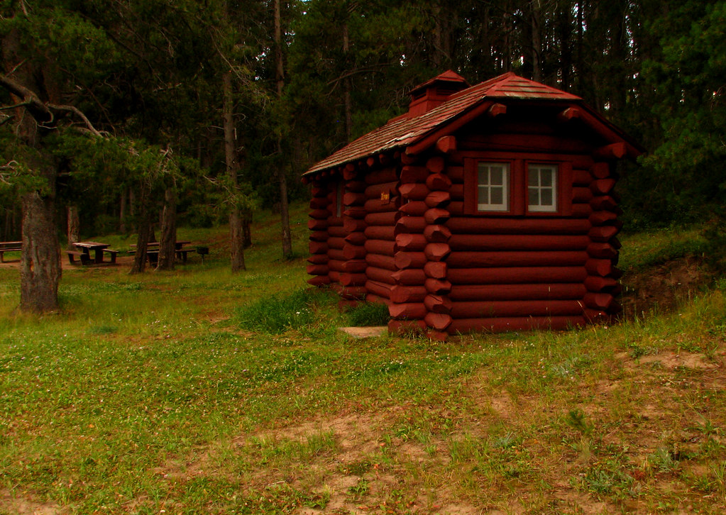
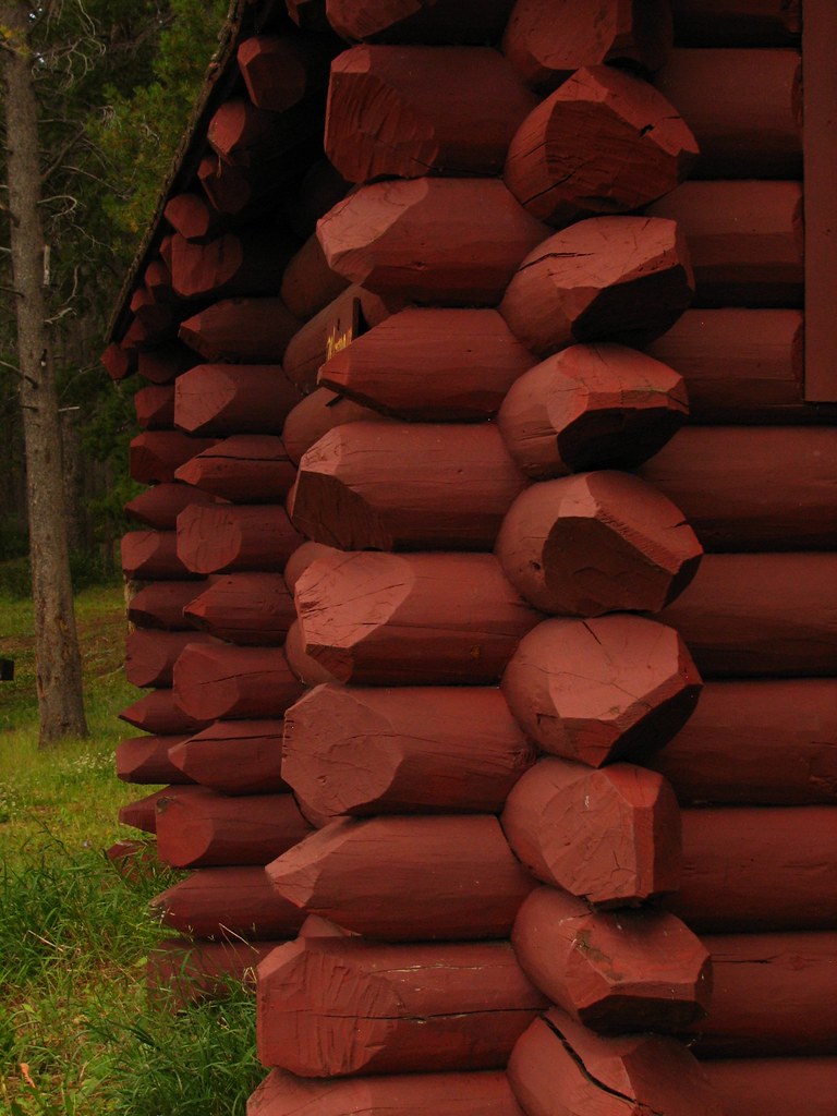
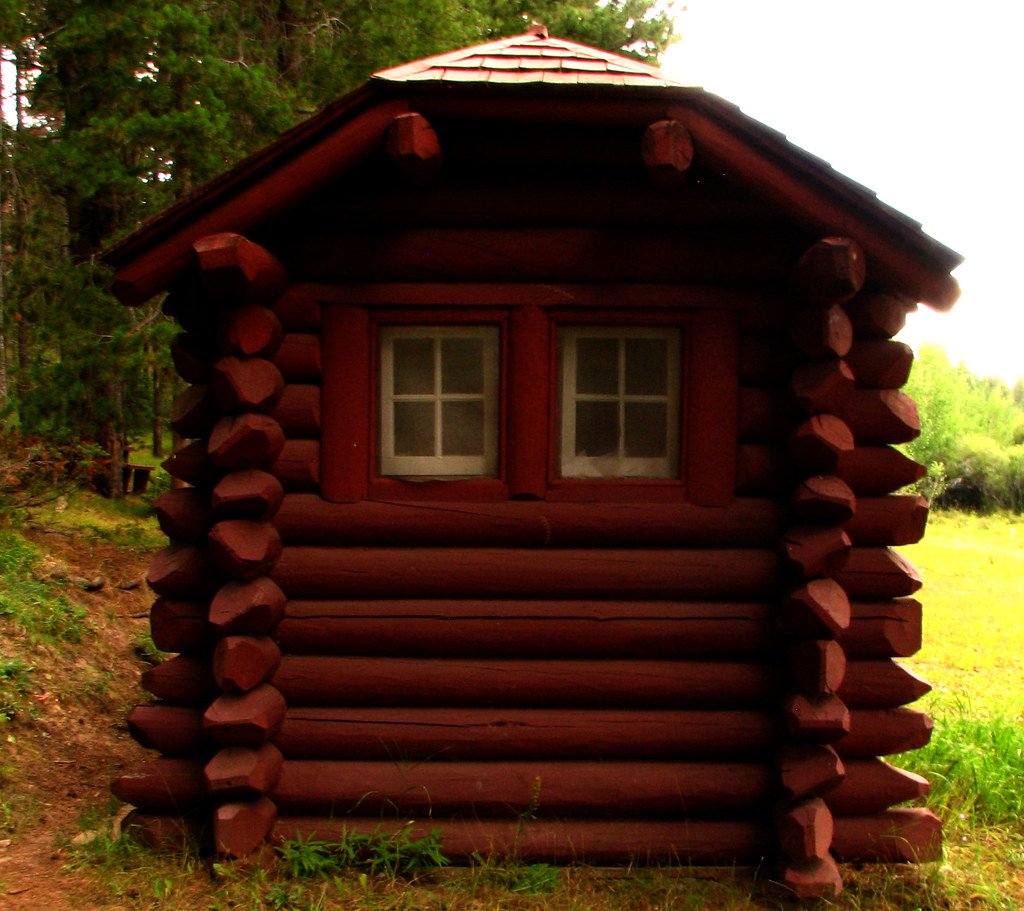
Civilian Conservation Corps log craftsmanship.
The great make-work program for restless young men of the 1930’s is known for its fine design, construction and use of native materials. A CCC camp operated throughout the 1930’s at Pole Mountain. Little remains, except for the forest itself! They planted 280,000 trees on the mountain’s denuded acres. Yet three of the finest latrines you’ll ever see in these days of fiberglass and concrete have lasted more than seventy-five years, exquisite examples of log artistry.
The best preserved is still in use at Wallis Picnic area along FS 705. You can access FS 705 from the Blair-Wallis exit on I-80 or from the Summit rest area, going south. (UTM 0466309 / 4561107) Another is hidden behind the trees at Blair Picnic Ground also on FS 705. (UTM 0467004 / 4559642) The third log potty, now closed, is in the Vedauwoo area along the road to “Beaver Ponds day use”. This one retains it’s original natural varnish. (UTM 0469145 / 4556440)
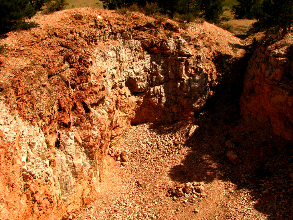
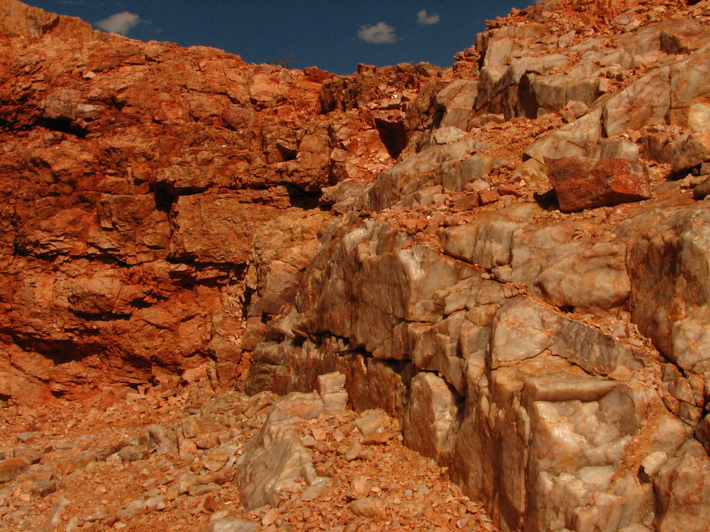
Uranium Mines.
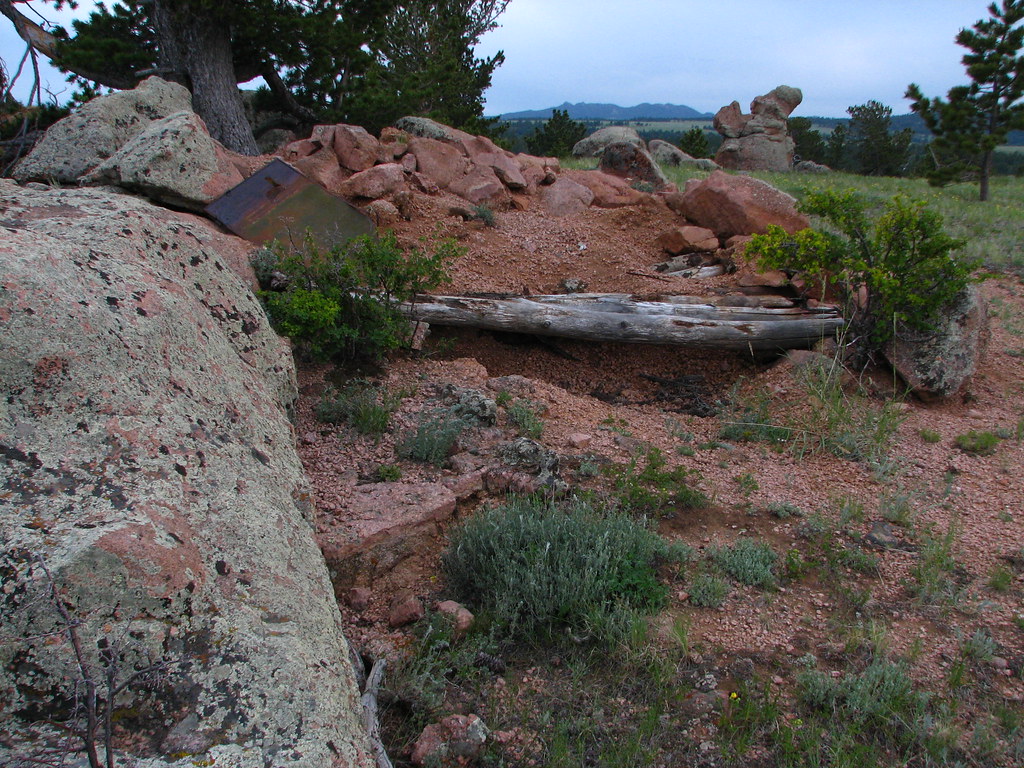
These two knobs have been cored to extract the quartz that holds uranium. Anyone have a Geiger counter? I wouldn’t suggest you take these rocks for souvenirs. From Happy Jack go north on FS 701, then east on 712, north on 714, north on 713, east on 713C, north on 709 to the far northeast corner of the forest. Keep an eye out for the salmon colored scars. The biggest mine is at the end of 709. (UTM 0474103 / 4572059) To reach the other one back track, taking 709A to its end. (UTM 0473800 / 4571838)
Aqueduct Opening.
While it doesn’t look strange at all, this pond and it’s lovely flow of laughing water may be the strangest thing of all. If you look upstream you’ll see that there is no immediate source for the stream. This water comes from the Snowy Range miles away via a pipeline taping Rob Roy reservoir. Completed in 1965, it pours into this small tributary of Middle Crow Creek where it flows into Granite Springs Reservoir, and into your kitchen sink, by way of the city’s water treatment plant. Go into Vedauwoo on FS 720, following signs to “Beaver Ponds day use”. Park and walk to the southeast through the trees. The pond is the end of the aqueduct. It‘s fun to follow the overflow from the culvert through the great rocks. (UTM 0469278 / 4556467)
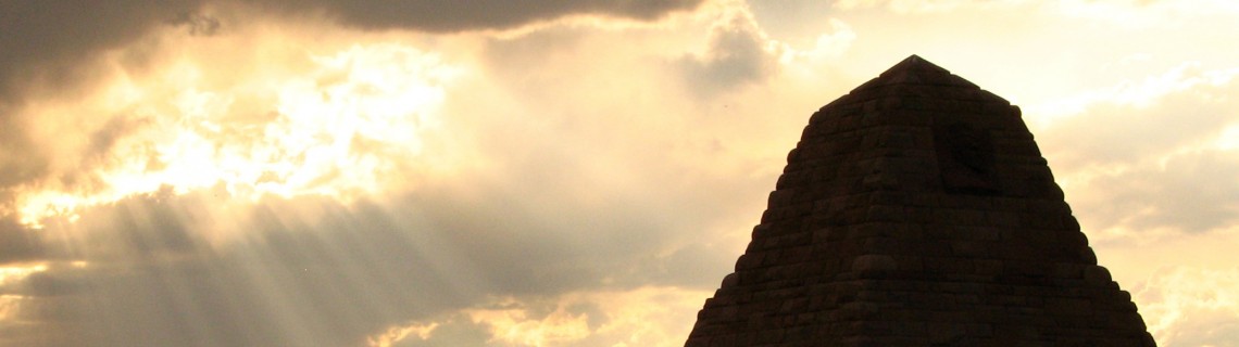
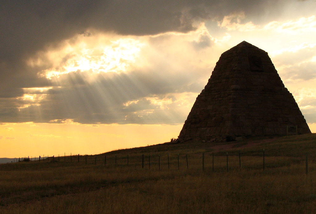
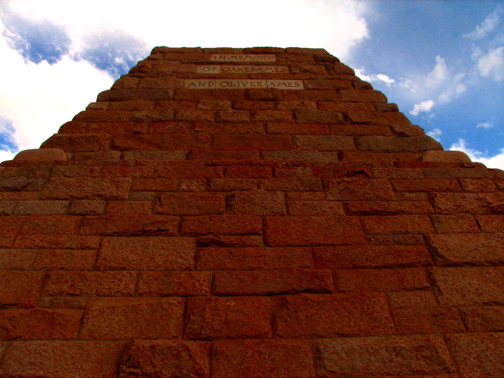
Ames Monument.
While hardly a secret, this pyramid is just too weird to leave off the list. Union Pacific’s celebration of Oliver and Oakes Ames was built in 1882 but was left isolated nine years later when the railroad moved its tracks to the south. From I-80 take the Vedauwoo exit but go west, under the freeway. Then take Monument Road south to the two-angled, four-sided wonder. Sadly, like most monumental pharaohs, the Ames have suffered the loss of their noses. (UTM 0466647 / 4553131)
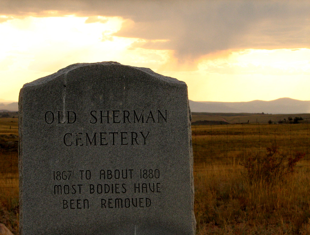
Sherman Cemetery.
What do you call a cemetery where most of the bodies have been relocated? A motel for the dead? Imagine being dug up. “I had hoped this was the resurrection but now you’re taking me to Cleveland?“ This sad little spot is a reminder of the dangers of building a railroad across the primeval frontier. It is less than a quarter mile northwest of Ames Monument and is all that remains of Sherman, a railroad town whose buildings were also relocated. (UTM 0466435 / 4553655)
Happy searching! If you come across more weird, man-made relics at Pole Mountain, let me know. There are some things I have never been able to find.
One is a pulley on the west side of a rock formation on the north side of Happy Jack Road close to the forest boundary. It was used along with a pulley on a pole to hoist derelict aircraft for target practice.
I also have never found the Buck Sullivan spring which is somewhere west of the first radio towers on FS 703. Several homesteads were located in what is now the forest. I wonder what remains.

Comments
Frank Mellblom
Oct 25, 2010
Thanks for the nice part II, great photos!
Just for fun, look at the original boundaries of
the military reservation on the old maps.
I always wondered why the almost “square” shape of the military boundary had a long,narrow extension running due East.
I think there was a reason for why the military wanted that extension: Hint, go off Happy Jack road, north on the junction of road 701 E. Look in the green brush fairly close to the old building foundation.
Ross Priesmeyer
May 3, 2013
Nice write up, I’ve seen most of these artifacts for my self when I was living in Laramie. I was hoping you had stumbled across an old concrete bunker, it’s somewhere along Happy Jack not to far from the hwy, but for the life of me I can’t remember where or seem to find any literature about it. It’s really neat if you ever get a chance to see it, two foot thick concrete walls, a heavy steel door and slit windows looking out over the valley. I know it’s easy to find considering the graffiti all over it, but none the less interesting. Happy trails!
Roger Ludwig
May 3, 2013
For the bunkers, check out an earlier post: http://www.awayfromthegrind.com/blog/hiking/wyoming/treasure-hunt-at-pole-mountain/ There are two of them, built in the early 1940’s for observers to watch and record the accuracy of various artillery.
Randy Martin
Aug 4, 2013
The photos you have of the Seismograph Boxes are a British site from my understanding. These are the sites that the Air Force operated in the 1950’s.
Pingback: Gold Processing and Extraction | Where To Find Gold
Pingback: 3 Favorite Local Websites |Just Trails
Pingback: Gold Processing and Extraction | Prospecting Gold
Dr. Robert A. Zawacki
Oct 27, 2015
I was stationed at F E Warren AFB from Oct, 1954 until Mar, 1959. I always had a fishing and hunting license for Pole Mountain and caught many book trout there and also shot many large mule deer.
When I was a SSgt, I was in charge of the personnel records for an AF detachment at Pole Mountain. I would drive up there once a year and give the airmen heir records check. The detachment commander at that time was a AF Captain. Most of the personnel at the site dressed in blue jeans and maybe a military shirt with their grade on the shirt. Also, at this time their was a sister detachment located downtown Laramie. Both sites were classified at that time. I was transferred from Warren AFB to Det AFROTC 940, on March 10, 1959. I continued to hunt on Pole Moutain through about 1962 and some of the AF people stationed at the classified site in Laramie would bowl in our league. Dr. Robert A. Zawacki, BS 62, MS 66, U of Wyoming, Ph.D. 1973 U of Washington
Bob Masson
Nov 5, 2015
Dr Zawacki – great story! I’m trying to find information on the seismic monitoring array that was built in the 50’s outside of Encampment, WY. The whole thing was classified – but it’s completely defunct now (now & then you’ll stumble across one of the stations). Might you have any information on it? Like the program name or anyone that might have additional information? Thanks much
Steve Kaminski
Dec 27, 2015
I was an Army Geodetic Surveyor attached to the Defense Mapping Agency at FE Warren from 85 to 89. Back at the section I had access to all the topo maps that I wanted. I still have the 2 maps that I put together that comprise Pole Mountain. They are 1:24,000 scale and dated 1948. They show most of the man made objects dating back way back. All the military buildings, bunkers etc are on it. I have since scanned it and I have calibrated it and I use it with a mapping program called Oziexplorer. Great fun! Back in the day I spent all my free time up there hunting fishing camping. Most of these items you list I have found but thee were a few surprises that I intend to look for on my next visit. If you are interested in my maps contact me.
PS Another fun hobby was locating all the Survey Benchmarks. Some of them are First Order…meaning Lat and Long are accurate to 1 millimeter. Done the old fashioned way with Astro Observations.
Lewis Lyon
May 31, 2021
I would love see these maps. I’m a Cheyenne native and have spent a great deal of time out here. Would be awesome to see these.
Jim Warta
Jun 27, 2023
Would like to get a copy of your maps, I’m currently working on compiling some of my own in the NE part of that area and have a 1906 and 1938 maps of the reservation and have found a few of the many DMA monuments.
Sharon Bryant
Apr 17, 2016
Found this site while looking for history of Pole Mountain Nat’l Guard Camp. Have photos of my Dad’s unit and their camp dated July 1932. Theirs was a mounted unit, horses and wagons. It was a tent camp with a few frame buildings. There were also large, round steel watering tanks for the horses. Anyone know any history regarding this period? It seems the camp was used for several decades before abandonment.
Beth Bailey
Sep 5, 2017
I have a photo of camp 9. Can you tell me anything about it
Jason Homola
Jul 15, 2018
Please I Would love to see the photos of the camps, I am putting together information on early military use of Pole mountain area.
Donna Thall
Jul 29, 2016
I didn’t know this history of Laramie. I have enjoyed learning about it from all of the comments. Thanks for sharing. Gotta love history!!
Roger Ludwig
Sep 5, 2017
Hi Beth – I’m hesitant to put your phone number on the comment section of the Away From The Grind site. It could be misused by someone. The Wyoming National Guard has a museum. I see that they are currently remodeling but you might call them and ask what they may have. http://wyomilitary.wyo.gov/veterans/museums/guard-museum/
Roger
George M.
Jan 14, 2018
Just a bit of history: When I was in UW Army ROTC in the mid-’60s we did explosives training at the old Pole Mountain Military Reservation HQ blowing up the old concrete foundations at the request of the Forest Service.
The large concrete bunkers were used for artillery observation. Almost all the artillery used at Pole Mountain post WW1 was 75mm (about 3″) caliber.
The Wyoming National Guard, then the 115th Cavalry Regiment (Horse mounted), used the area for annual training during the 1920s and early ’30s. There may have been some pre-WW1 use as well. In the late ’30s they started using Camp Guernsey because of better weather at lower altitude.
Dr. Robert A Zawacki
Jan 14, 2018
I found George’s comments on using explosives on Pole Mountain in the Mid 1960s very interesting. I was with the USAF AFROTC Det 940 from 1959 to 1962. The Army ROTC was very near us in the Old Gym – now remodeled. Last Summer My wife and I drove over to Encampment and visited their museum. It is a very detailed and excellent museum but they have nothing about the AF detachment that was located near Encampment in the 1950s. Dick Peru, former mayor of Saratoga and publisher of the local newspaper for many years, told me that he often gets questions about the former AF Site when he gives his local history lectures.
Bob Masson
Jan 15, 2018
Actually, the Encampment museum does (or did) have some info on the AFTAC detachment that was based in Encampment. See this https://www.youtube.com/watch?v=TzmAZr5gfjE
I’ve been researching AFTAC in Encampment for a couple of years – have a fair amount of info if anyone wants to see it. Have visited three of the sites that were up above Encampment (they were buried seismometers). There’s still some old wire up in Deadhorse Park. And you can see some of the wire trenches that connected the seismometers from Google Earth.
There was a similar site up on Pole Mountain as well.
Jon
Jul 6, 2022
You have some wonderful articles on the area. On the feldspar mines you show, there are 4 of them in the area, the old mining camp for them is between the top two, which are located north of the two you show, on some state land. The two you show were demolished by the usfs in september of 2020. They would make a handy spot for the goverbment to hide something.
There are some old building ruins and a corral west of mc kechnie meadow, on some private land. It is visible from the forrest boundry.
The sullivan spring you mention, i have not found, but the road that goes up to the first set of radio towers has a small section of stone wall, possibly from a building not for off of the road.
There are some small concrete box structures built into the cliffside near the first set of radio towers on the right of pilot hill road, when traveling away from i80 on that road.
There is an old spring with some excellent stone work boxing it in, not far off of the trailhead that starts off of head quarters road. The area is near the creek 210 crosses, and can be accessed quicker from one of the pull of spots on 210, headed west across a meadow. It is unfortunately dry, but must have been quite a spring judging by the flow rate.
A map from the 1960s has labeled “abandoned camp” somewhere in the area a couple miles west of where you show the abandoned kitchen.
It makes me quite sad to observe the great dis service our own forest service has done to us by not properly maintaining this area of the mountains. They choose to close off many of the roads leading to great spots, and have let the ccc camp bathrooms you mentioned fall into a state of disrepair. Hopefully the forest service can improve and restore this wonderful section of mountains. While its not the biggest or the most remote, it is of high quality, and accessable to more people than any other section of mountains in wyoming.
Anonymous
Nov 17, 2024
I was in USAF & stationed in Encampment, WY for three years in late 1950s — there were roughly 15 airmen stationed there. USAF installation there was a seismic station designed to detect nuclear blasts. Seismometers were located in mountains above Encampment in linear arrays of instruments that intersected at a 90 degree angle which help determine the direction from which the surface seismic waves arrived . Encampment was part of USAF seismic stations worldwide, all configured regionally in a 3-station array to detect & measure the size and directional vector of nuclear tests.. There were three USAF seismic stations in Wyoming plus a civilian site on Pole Mountain (between Laramie & Cheyenne). After discharge from USAF I also worked at Pole Mountain site while attending U of Wyo. Pole mountain was operated by Geotechnical corporation headquartered in Garland TX pursuant to a contract with the USAF. There was also a British staffed seismic station on Pole Mountain but it closed shortly after I started working on Pole Mountain. Also, while attending U of WY Geotechnical Corp send me & two other veteran seismic station operators to Mould Bay NWT Canada (an island in the Beaufort Sea) to instal a seismic station on the permafrost — to determine if permafrost base, low microcosm noise & proximity to USSR nuclear testing site would yield superior results — once site became operational a new team was brought in to operate the site. The installation & operational launch took about four months. The facility at Mould Bay was then a U.S. & Canada jointly operated weather station & we used their electrical generation, housing & mess facilities. Access to Mould Bay was via air & we arrived on USAF aircraft & left on RCAF plane. My security clearance in USAF was top secret & we reported our daily observation via encrypted teletype to Geotechnical Corp which then coordinated with other seismic sites around the globe pinpoint the origin of the nuclear blast. There were also other classified operations (chemical, aircraft, etc) to supplement the seismic stations but we had no contact with these ancillary operations.
Jeff Payne
Jan 13, 2025
What is the name of the body of water offbof Happy Jack road in the Vee Da Voo area?
Thank you
Steve
Jun 18, 2025
Recently I found another structure you haven’t shown. It is located off of Headquarters Rd and has very little vandal damage. By the markings it was built by the Army Corps of Engineers in 1910. I believe it is a water storage “tank” but is square. I wish I could find more information on it but I lack resources to any of the old military records or information.
Roger Ludwig
Nov 2, 2025
It’s a great find, isn’t it! I first saw it on Google earth as a rectangle. And yes, it was a water reservoir. When the National Guard volunteers trained there they had hundreds of horses needing water. It must have been an incredible sight to see, all of those riders doing drills. We can get a little glimpse of it in the 1936 movie “The Plainsman.” While most of the 1936 spectacular was filmed on the Cheyenne Reservation in Lame Deer, Montanna there are some shots in Vedauwoo. I spent a good afternoon locating the site the camerman must have stood on to film it. By the way, according to the American Film Institute catalog, two Wyoming National Guardsmen where badly hurt during the filming of a cavalry charge. Another film starred the Wyoming National Guard at Pole Mountain, the 1912 silent “The Charge of the Light Brigade.” (You can find this one on YouTube.) The number of horses is staggering, as is the Wyoming wind. I was also struck with how overgrazed the prairie is and the complete lack of trees.