A “Treasure Hunt” of the Weird and Wonderful at Pole Mountain, WY
The information in this piece may be out of date. I have moved away from Cheyenne and am no longer maintaining this site. You may leave a comment if you wish. Useful comments will continue to be posted.
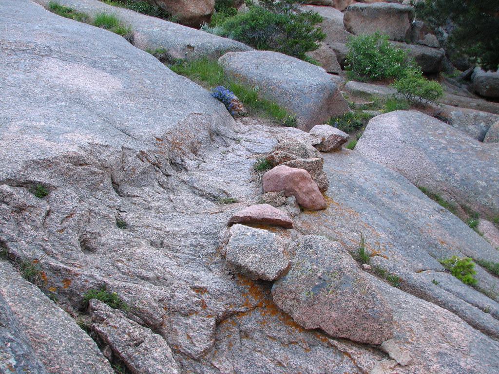
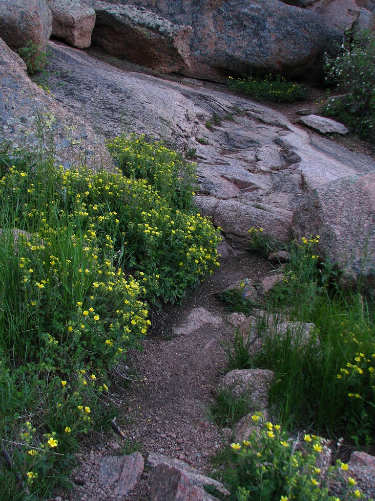
Veduawoo and Pole Mountain is Cheyenne’s back forty. We love to play up there, all with our different passions: fishing, four-wheeling, camping, hiking, climbing, hunting, skiing, sledding or just messing around on the rocks.
The rocks are monumental sculptures, painted with lichens in green, orange and black. The beavers have crafted jewels to reflect the sky. There are the twisty groves of aspens, forests of ramrod straight pines. It’s rare not to see deer and antelope.
If you’ve wandered around much, enjoying the wonderful, you have probably stumbled across some of the weird.
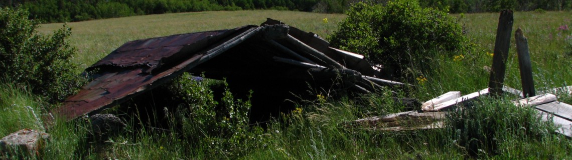
After all it was a "Target and Maneuver Range" for more than 50 years. The Army, Air Force, ROTC and National Guard guys all had some fun blowing things up and shooting things down. There once was a headquarters with 18 buildings.
And before that there was the town of Tie City. Telegraph poles were taken even earlier for a telegraph line along the Overland Trail. A highway man lived up on Brown’s Landing, robbing travelers. Uranium mines were blasted from the rock. There was a Civilian Conservation Corps camp. The Happy Jack Ski area operated for many years and there was a lodge where the summit rest area is now.
Frankly, there is a lot of weird stuff to be found.
Here’s a little "treasure" hunt of some odd places I‘ve run across or discovered by searching old records and scouring the ground. Interested? See how many you can find.
A GPS would get you there the fastest. But the UTM coordinates (NAD27) can be used with a USGS topo quad. Or just follow the directions. You will need a good map.
By giving you these locations, I’m trusting these sites to you. Let’s leave them be so we can take our kids and grandkids there for years to come. Please don’t kick a stick or chock a rock. Besides, if you disrupt any artifacts, the mummy’s curse will follow you for the rest of your life.
The Forest Service archeologist asked me to remind you that the use of metal detectors at these sites is illegal. It would also be stupid. One trowel jabbed into a live shell could just blow you up.
So, whether you go by truck, ATV, mountain bike or by foot, have fun. Let me know what you discover. If you find any other weird and wonderful stuff put a comment at the bottom.
-
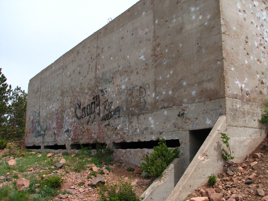
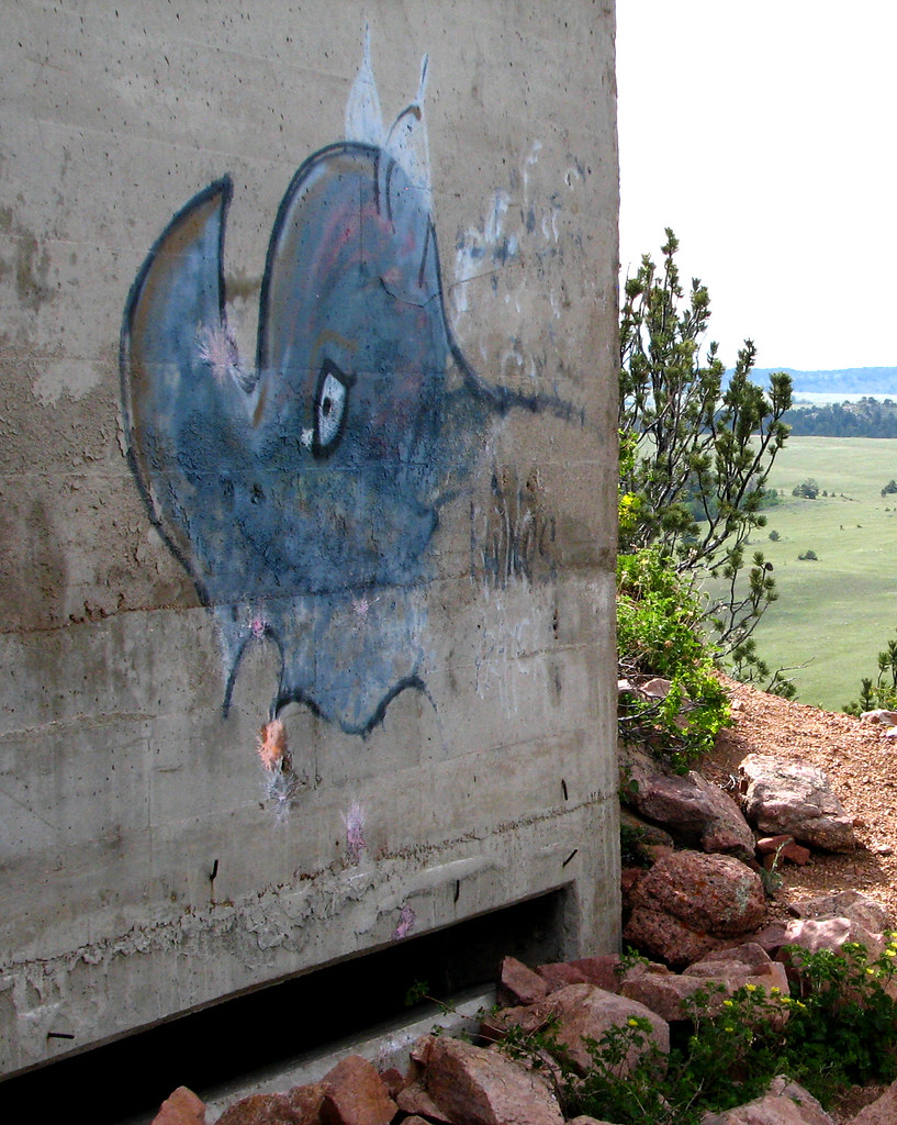
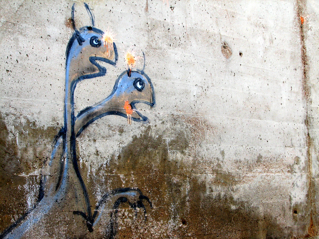
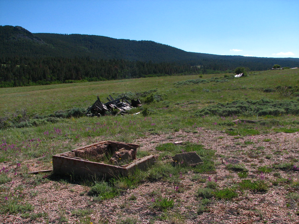
Merritt Hill concrete observation bunker.
(Named after Wesley Merritt, a veteran of the Indian Wars, commander of Fort D.A.Russell from 1867 to 1877 and again from 1879 to 1880 and later Commandant at West Point.) Take FS 701 north from Happy Jack. Turn right just before the corral on FS 701G. (UTM 0471282 / 4563977)
-
Bisbee Hill concrete observation bunker.
(Named for Major William H. Bisbee who was also at Fort Russell in the 1800’s.) From Happy Jack take FS 701 north. Turn left on FS 701C. Keep right at each intersection to the end of the road. It’s really not on Bisbee Hill. (UTM 0469031 / 4566467)

-
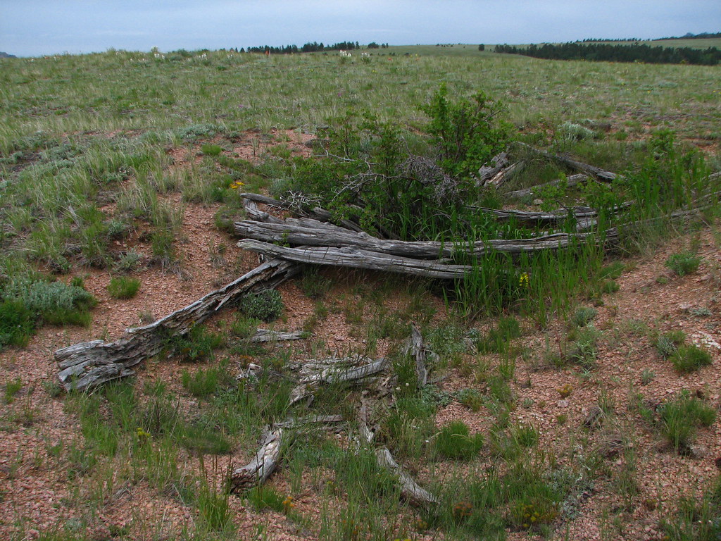
Two collapsed bunkers with log roofs, connected by trench work.
They face the Bisbee Hill bunker. FS 701 north until it becomes the left fork of FS 712. Then park at the high point, walk to the ridge top to the west. (UTM 0469403 / 4568006)
-
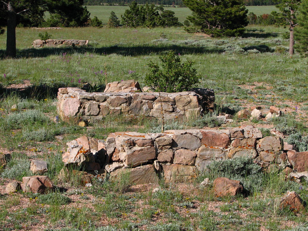
Military Headquarters.
A well head, a rock wall, a few foundations and the traces of old roads are all that remains of what once was the military command post. From Happy Jack go south on Blair Road (FS 707). It’s north east of the "Headquarters Trail Parking", across the road. (UTM 0467700 / 4563149)
-
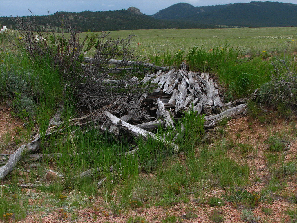
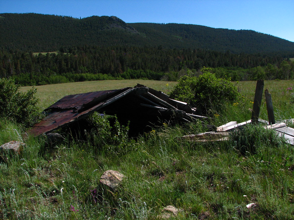
A dozen or so old rifle pits or shelters from a time prior to WWII.
A few of the tin roofs and walls remain, perhaps the most preserved of any of the old sites. Just north of Happy Jack at the big bridge over South Lodgepole Creek. Park on Happy Jack and walk, going over or under the barbwire fence. (UTM 0467580 / 4566790)
-
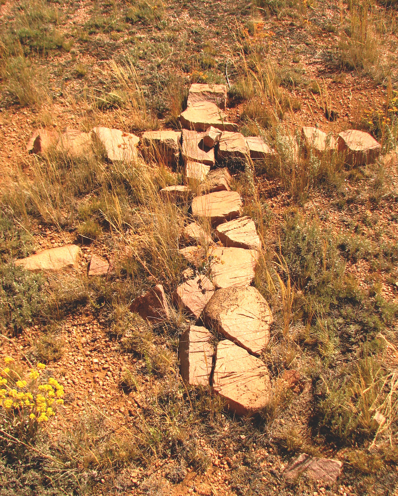
Graves dating from long ago.
Buried here is the body of a young boy struck by lightning nearby as he rode to Laramie on the Cheyenne Pass Road and the infant daughter of local homesteader, Ben Black. It looks like there is at least one more grave. FS 701 north, Left on 712. Right on 702. Right on 714. Off the road in a copse of trees to the right shortly before 713. The rock cross near the road points to the graves. (UTM 0472410 / 4569464).
-
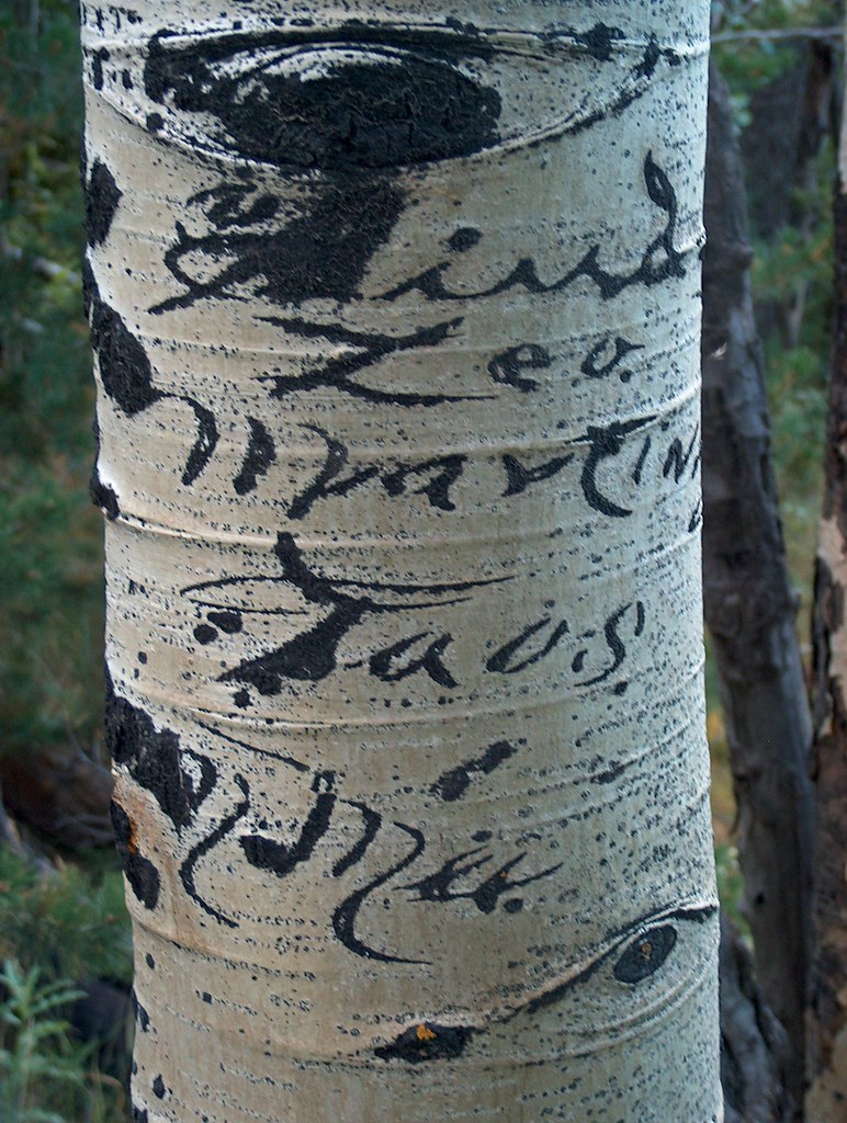
Laycock Spring and aspens carved by Spanish herders in a graceful script.
North off Happy Jack on FS 703, turning through the Tie City overflow parking area. At junction of 714 stay on 703, a very rocky, high-clearance track. Turn left on 703G, continue for a quarter mile. (UTM 0461772 / 4571674)
-
"Laramie" rock.
This rock once was on the stage road between Laramie and the town of Sherman, now only a site. It was moved here in 1970 when the rest area was built, both to protect it from theft and to allow more people to see it. It could still be made out in 1967: “Harry Satlak C.R. Laramie 9 1/2 -> <- Sherman 9 1/7" The rock is in a place of honor by some trash cans at the summit rest area. (UTM 0463540 / 4564951) The site the rock was taken from is marked with a bronze plaque and is off of FS 726. The bed of the stage road is still visible, although overgrown. (UTM 0462008 / 4566443)
-
Happy Jack Ski area.
There really was a rope tow pulling skiers up the open run. Two old light baffles high up on pines are all that remains. From Happy Jack turn south at the Happy Jack Recreation Area, then the first right into "Winter Sports Parking". (UTM 0464424 / 4566802). To the east is the bottom of what once was an iced toboggan run (UTM 0464840 / 4566708)
-
Vedauwoo Glen performance stage steps.
The University of Wyoming Players gave "historical spectacles" here in this natural amphitheater. Take FS 720 into Vedauwoo either from I-80 or from Happy Jack, going south on FS 700 to FS 720. Park at the end of the "Box Canyon Day Use Area". Walk the paved trail into Box Canyon, continuing on the gravel trail. Cross the foot bridge at the end and look to the left on the hill for rocks placed in a row, marking the old trail. See if you can follow the jack-hammered tread, carefully placed rock steps and stubs of steel posts up the stairs to the stage and then beyond to the lookout. In our tennis shoes there are easier ways but for women in long dresses and leather-soled shoes, this was the genteel approach. (UTM 0468469 / 4556924)


Comments
Randy Martin
Aug 24, 2009
You missed one of the more interesting things in the Pole Mountain area. The concrete box that contained a seismograph for monitoring the Russian nuclear bomb tests in the 1950’s. It was one of three locations in SE Wyoming for this purpose. It is the Twin Peaks area and it has been years since I was there. Even the Forest Service personnel I talked to did not know about its existence. The only reason I knew about it was through our neighbor in Laramie who was the Officer in Charge of the three sites. I’ll have to check my maps to get a location for you.
Roger Ludwig
Aug 24, 2009
Now that is truly weird, and fascinating. Anyone know where this is?
Thanks Randy.
Mike Hancock
Mar 28, 2010
I didn’t see any mention of the Ames Monument (pyramids) or the Lincoln’s bust memorial. I found those to be quite interesting as a kid growing up in Laramie.
Roger Ludwig
Mar 28, 2010
They’ll be included in the next installment.
Erwin
Apr 28, 2010
Someone has asked me about an old bunker that was off the Vedauwoo exit. Does anyone know about a bunker in that area?
Roger Ludwig
Apr 28, 2010
Hi Erwin – I don’t know of anything like that near Vedauwoo. The military never did any shooting over there because it has been a picnic site and performance stage going way back. I bet they are talking about the Merritt Hill bunker. It’s the one that is well known. You can get there from the Vedauwoo exit but it is a distance. Roger
Jim Arehart
Jun 13, 2010
Hi
I grew up in Cheyenne and went to school at U of W in Laramie. I’ve been living in Arkansas for the last 14 years now but Pole Mountain and Vedauwoo is my old stomping grounds.
We used to camp out in the area of Reynolds Hill and the old Military Reservation and I remember, back in the early ’70 we ran across the ruins you have photographed.
I wasn’t into taking many pictures then and I lost track of these old ruins as the years went by. I remember, 20 years later in the early ’90s, trying to find those old observation bunkers time and time again but to no avail. (We figured they were machine gun emplacements.) I concluded they were demolished but I see you have re-discovered them for me. Actually I think it is great they are so out-of-the-way.
Keith
Jun 22, 2010
Possible location of sites Randy was talking about from http://neic.usgs.gov/neis/station_book/P_NAME.html
Pole Mountain
Code: PM-WY
41.2075 -105.3608 2469.0
Network: LRSM
Status: Closed
Pole Mountain
Code: PMW
41.2100 -105.3347 2440.0
Network: BKN
Status: Closed
The lat/long look about right
Roger Ludwig
Jul 3, 2010
Help! I went out to locate these with a GPS and had no success. One leads to a place just south of Happy Jack. There is one unusual thing nearby, the fence post was painted yellow then repainted white while all other posts are unpainted.
The other is a bit remote, a 1/3 mile walk from the nearest four wheel drive road. Couldn’t find anything.
Any body have any ideas? Roger
Frank Mellblom
Jun 30, 2010
My brother and I explored Pole Mountain from 1966 to 70’s college days at U.W. One interesting site is shown as “Artillery Spring” on the older maps. I have a photo of it when it was neatly rocked in with a nice outlet pipe. I haven’t been back for years,but hope to again pretty soon! P.S. Hi to Jim Arehart above, I was in East High class of ’69 in Cheyenne.
Roger Ludwig
Jul 3, 2010
Stay tuned for the next installment. I found this last fall, tromping through the brush. The spring flows nicely.
Roger
Jeremy Knowlton
Aug 31, 2019
Please share your picture and please take picture of map and share!
Keith
Jul 6, 2010
Roger,
I wonder if the datum needs to be changed (don’t know how much it would be off if a different datum was used). The website doesn’t state what datum is used. I would guess it would be NAD-27
Steve
Aug 13, 2010
Very interesting information you have provided. I just moved to the area and discovered the beautiful Pole Mountains today, Hiked for 3 hours over at Curt Gowdy. Noticed trailheads off 210 and want to do some exploring. Can you recommend somewhere to acquire trail maps for the area?
Roger Ludwig
Aug 16, 2010
Hi Steve – Glad you’re enjoying the area. For maps the place to begin is definitely the Forest Service’s Medicine Bow National Forest Map. It covers the wonderful and bewildering network of roads in Pole Mountain as well as the Snowy Range and Sierra Madres.
You can buy one from the Forest Service in Laramie by calling (307) 745-2300. Ask them to mail you the free pamphlet maps on Turtle Rock, Headquarters Trail and the cross country ski trails (which can also be hiked).
You may want more detail. For that the only choice is the two USGS maps, Sherman Mountains East Quadrangle and Sherman Mountains West Quadrangle. It’s probably easiest to get them from the internet at http://topomaps.usgs.gov/ Hit the finding and ordering USGS maps button. Sadly some of the newer trails on not on these.
Marc Smith has a book trail guide, Hiking Wyoming’s Medicine Bow National Forest, which covers Pole Mountain as well as the rest of the forest. It’s readily available in Cheyenne and Laramie book stores.
For Curt Gowdy State Park, they have a trail map that is downloadable at http://wyoparks.state.wy.us/Site/SiteInfo.asp?siteID=4 Click on “trails brochure”. I think they will also mail you one or they may be available when you pay your entrance fee at the park gate.
Have fun!
Roger Ludwig
Oct 21, 2012
UPDATE on MAPs. There are two road maps for Pole Mountain that I was not aware of when I answered this in 2010. Both are excellent. The first is “Motor Vehicle Use Map Medicine Bow National Forest Pole Mountain” Published Jan 1, 2010 I think it is free from the forest service. Call (307) 745-2300. The second is “Pole Mountain Travel Map 1983”. It was revised in 1991. I bought one for $2.00 at the Cross Country Connection store in Laramie. It has topo lines and streams on it. The “Motor Vehicle Use….” one does not but it may be easier to read while driving. Roger
Mike Lewis
Mar 5, 2011
This is a cool site! I like these kinds of things. Im at Wyotech right now (bad connotation), and enjoy driving up in these hills, and taking the motorcycle out for a ride in these remote regions. I was driving around up on HJ road about a week ago, and saw what I assume is the Merritt Hill bunker form HJ road. I braved the snow and wheeled myself up there and was pleasantly surprised to find this bunker. When the snow melts, and for the 1 month of summer here in Laramie, im going to do some more exploring, get a cheap GPS and try to find the rest of these places. Or learn how to use a map.
Thanks for posting these up!
Aaron
Apr 8, 2011
do you know where the water fall is ? i thought it by the devils playground. thanks
Christine
Jul 9, 2011
Rodger, Thanks for the site. I’ve been hiking Curt Gowdy all summer (my goal to hike every trail before school starts), but now you have given me so many more reasons to hike Medican Bow NF. I hike for exercise and to be outdoors. When I have things to explore, goals to get to I do so much better at getting out a couple of times every week. Thanks for all the new goals. I look forward to more posts about the area. BTW I live just a short distance from Woodhouse and you’ve given me more reasons to explore the area further! Looks like they will be great falls hikes as there is not much shade.
Frank Mellblom
Jan 24, 2013
Enjoyed your presentation at the Wyoming State Museum tonight. One of your slides showed a horseback rider with an arrow pointing to a movie camera location. There was a 1936 movie called The Plainsman with some scenes filmed at Pole Mountain,Wyoming. I found this on the movie reference website http://www.imdb.com , and found a copy on DVD.
Look at the “filming locations” link at the bottom of the IMDB movie page.
Frank
Roger Ludwig
Jan 25, 2013
Astonishing! Just when I think I’ve heard everything about Pole Mountain something else amazing comes up! I looked up the movie. Directed by Cecile B. DeMille staring Gary Cooper! In 1936, at a time when the CCC was there, as well as the army and national guard. I wonder if there is any information in Laramie about it. I’ll see what I can find out. The film is on Netflix. Hopefully I’ll get a chance to see it soon. Frank, thanks for bringing this to our attention. Roger
Roger Ludwig
Jan 25, 2013
Frank, I just found out a little more, from the IMDb site:
“The cavalry sequences were shot with members of the Wyoming National Guard. Two guardsmen were badly hurt during filming of a charge scene.” – That explains why this photo was at the WY National Guard Museum.
“2,000 Indian actors were used as extras for the Custer massacre sequence.”
“An excellent horseman from his youth in Montana, Gary Cooper did most of his own riding stunts, including the shot where he rode “hanging” between two horses.”
Frank Mellblom
Jan 28, 2013
Roger do you use the UW Library for research on Pole Mountain? Thanks for your efforts to bring attention to the history of the area and encourage respectful exploring.
I did find a little more about movies filmed up there. In 1912 a Edison short film was made using “800 calvary riders from Ft. D.A. Russell” to portray the British and the Russians in the first of many “Charge of the Light Brigade” movies. There is a great Wyoming movie site run by Mr. Wally Farmer, http://www.theastrocowboy.com
where I found reference to the Edison movie.
This 12 minute silent movie is available in a collection on DVD through Amazon,which I will probably purchase for fun.
There is a very brief segment on YouTube,”A History of Cinema” in a compilation starting in 1895, just watch to the 1912 segment. Frank
Roger Ludwig
Jan 29, 2013
More amazement. Enjoyed watching the youtube snippet. I’d like to see more to figure out just where they did that charge. Just what was it you found the section in? I saw that it was included as an extra in some versions of the 1968 “Charge of the Light Brigade” – Region 2 DVD release but couldn’t find that one for sale.
Roger
Frank Mellblom
Jan 29, 2013
Roger, if you go to Amazon.com type in Nickelodia #1
If you spell it nickelodian, it won’t get you to the DVD. Interestingly this DVD has a nice package cover, featuring a movie poster of the Charge of the Light Brigade. Hope to get it pretty soon. Lastly Wikipedia has some information on the 1912 movie.
Paul Ruble
Aug 17, 2013
I think I might have found the artilary spring today. I was hiking up the side of pole mountain and found an old iron pipe line. I followed it to where it ended into what was once some kind of a stone and log building?
Roger Ludwig
Aug 17, 2013
Sounds like you found the old army reservoir. Was it quite a stone construction with some wooden boards as debris in the bottom? It is not far from the old headquarters, to the north west, with no trails leading to it. Artillery spring is a small concrete box with a pipe protruding from it flowing with fresh spring water deep in the brush. I’ve been planning on writing a list of more treasures to locate with this reservoir being one of the best. Roger
Frank Mellblom
Sep 5, 2013
I hiked up to the old reservoir and took some photos this week. It is very impressive. If my printer cooperates I will make some copies and send to your office address. Feel free to scan and post them if you wish. Google Earth has been a great help in findind these places.
Pingback: Hidden Secrets of Pole Mountain | LCCC Life on Campus
Kyle Schmidt
Nov 24, 2013
Another relic that you should include is the large concrete arrow just off of Pilot Peak road. Here is more info on it and includes a link to the one one Pilot Hill: http://www.messynessychic.com/2013/11/15/the-forgotten-giant-arrows-that-guide-you-across-america/
It is really easy to find, take Pilot Peak Road (the one across from Tie City Trailhead) and take the first right on a service road. The arrow is at the top of the hill behind the brick building.
LenSatic
May 19, 2014
Kyle, that’s not it. It’s several miles to the east. Here’s a map listing them: https://maps.google.com/maps/ms?msa=0&msid=213732418950957933334.0004e1e9dedbfbfa2281f&dg=feature
LS
Roger Ludwig
May 20, 2014
LS, I appreciate your interest in the blog and the sites on Pole Mountain. I checked the map that you referenced. Interesting, as people have posted many beacon sites. But there were far more. Just between Cheyenne and Laramie there were three that I have seen pictures of, two east of Pole Mtn and west of Cheyenne. The Pole Mtn site is the real thing. You should go up and take a look. Roger
Pingback: 3 Favorite Local Websites |Just Trails
Angela
Oct 24, 2016
We found 4 green metal things just off the first Blair Wallis road. There is cables inside too in the bottom. Bullet holes on outside. They are in the ground. 3 by 5 foot deep. Anyone know what they are?????
Roger Ludwig
Oct 24, 2016
Hi Angela – Do you have a photo? A more specific location? Roger
Fred
Jul 25, 2020
Those are communication wire junction boxes that linked various locations / sites via field phones / telephones.
Fred
Jul 25, 2020
You’ll find one of these comm junction boxes / pits near the position where the old caretakers shed was.
Fred
Jan 22, 2017
Many years ago I used to hike all over in this section of Medicine Bow. Knew the place VERY well.
There is a large cement cistern on a small knob hill located northwest of the military headquarters, on the opposite side of the Blair Wallis road from the headquarters, that supplied water to the headquarters. It used to have a wooden roof over it that has long since collapsed. On the top of one of the four cement walls that make up the cistern, someone wrote the unit’s name in the cement before it dried. The unit’s name is the 10th Mountain and the date, I believe, was sometime during 1910.
Found a fired 75mm projectile on the south side of Happy Jack Rd. It was far off the beaten path near Headquarters Rd. The projectile was intact, minus the fuse assembly.
East of the military headquarters in a small grove of small trees is a large stone / cement “fireplace” which is known as the “National Incinerator” on one of the very old maps (1938 ?) that I have of the area. There is a large trash pit nearby that was bulldozed over but has eroded in places where you can find the old screw top beer cans that resemble brake fluid cans. There are pieces of the traditional white china with blue stripes that the military of the time was famous for having in their mess halls.
If your observant as you wander around in the area, you’ll notice cut off telegraph poles forming straight lines between former emplacements / structures in various areas throughout the former Pole Mountain Military Reservation. Some of these former comm lines lead to other interesting finds.
On the north side of Happy Jack Rd. there is a grave / monument of some sort that could be for a mascot of a military unit. It’s fairly large, I’d say the square of logs that surrounds the small, short cement obelisk is about 10′ x 10′. The obelisk has a small round disk (4″ to 6″ in diameter) that has an embossed pyramid shape on it. Below this disk, there is some glass jewelry that was embedded in cement of the obelisk when it was still wet. I did not see any writing anywhere on this monument.
Roger Ludwig
Jan 24, 2017
Dear Palerider,
Your comment and observations are very interesting. I’ve been to all of the things you have pointed out except for the obelisk. I’ll be on the look out for it. Any idea where along Happy Jack?
I’m hesitant to post your comment on the site. After I wrote one of the articles someone heavily vandalized the rife pits, stripping off the metal roofing and carting it away. What had been there for probably more than 70 years is now gone. I hope that my writing didn’t have anything to do with it but then again it might have. So now I’m siding with the archeologists who generally recommend keeping things quite until they can be preserved in some way.
Thanks for taking the time to write and now giving me something new to search for.
Roger Ludwig
Palerirder
May 12, 2017
Roger, that is indeed sad about the vandalism of the rifle pits. I won’t betray the location of the obelisk as it appeared to me to be more of a grave site than a monument.
I also found some remnants of a structure on the south side of Happy Jack that are not listed on your site. There was a wooden structure of some sort that had a shallow rock / cement foundation (no basement) at this site. The structure’s cement steps were still upright but parts of the foundation were broken.
I love to explore these old sites. I was fortunate enough to have gone TDY to Cold Bay, Alaska before the massive WWII base (Ft. Randall) was erased by a environmental clean-up operation (EPA?). Spread out across the tundra were dozens of large Quonset huts. All of the Quonset huts were in pits which sheltered all but the top 1/4 to 1/3 of the hut from the fierce winter winds. It was quite a weird feeling walking into these old WWII Quonset huts and seeing something like, “Thomas Hartwig 11 November 43” written on the arched walls of the hut.
Lee
Oct 30, 2017
I ran across a large stone lined pit out near the bunker on Bisbee Hill. There is some historic glass fragments in it. Anyone ever seen it before? My thought is that it could’ve been some sort of burn pit for the military.
Thanks!
Sheila
May 29, 2018
I found an old cistern on 701d. Do you know anything about one in that area?
Roger Ludwig
Jun 4, 2018
Yes. On old maps the place is listed as the caretaker’s house, being the person who looked after the military headquarters buildings. Up on the hill above the cattle gate you can see a level place where the house once stood. Also, down at the road, are two sets of decaying concrete steps that led into the barns. I have wondered if the house was originally a homestead that was not torn down when the military expanded the reserve. Anyone know more about this?
Sheila
Jun 10, 2018
Thanks! I guess the name Caretaker’s. Road should have given me a clue..
Roger
Jun 11, 2018
Sheila, I’m not so sure this is the cistern you found… I was looking at the map and this is not at 701D but at the junction of 701 and 701E. 701D – is it close to 701? Can you see it from the road? Roger
Sheila
Jun 11, 2018
No, it is 7 /10 of a mile down 701d, past where the gate crosses the road. It is on the east side of the road and yes, I think you could see it from 701d. I will go back and get some exact coordinates.
Sheila
Jun 17, 2018
Some more details. It is 1.1 miles down 701D. It’s is a few hundered yards to the east off the road and no you cannot see it from the road. Lat and Long are:
N 41.24968 W 105.32334.
Hope that helps someone. :- )
Roger Ludwig
Jun 18, 2018
Hi Sheila,
I will be sure to check it out. Around 1900 the forest reserve was much smaller. Homesteads were established around the edges of it. Then F.E. Warren was instrumental in getting the reserve enlarged by buying out those homesteaders. (He then got the rights to graze his sheep on the newly expanded reserve!) I wonder if what you have found is the remains of one of those homesteads.
It would be fascinating to see if the Albany County Clerk has maps and deeds that indicate who had homesteaded and where their homes were.
One of the homestead sites you could visit is called the Lattas Ranch on South Fork Middle Crow Creek. It is a beautiful place to hike. Take the Vedauwoo exit then instead of going into the fee area take FS 700 to 700C. Turn right on 700C and follow it until it makes a 90 degree turn to the left to follow the creek. Park there and walk due south, crossing the creek. There are two leveled sites. An old well is there with stuff thrown in including the broken remains of an old wood stove. I love hiking upstream along the creek. The rock formations on the north are beautiful.
Roger Ludwig
Jun 24, 2018
Today I visited the “cistern” you discovered. I think it is a well blasted out of the rock but one that doesn’t produce enough water to be useful, not flowing enough to reach the outlet hole. It is certainly not old enough to match my theory of a homestead site but probably created to water cattle.
Sheila
Jun 3, 2018
Can anyone recommend an app that takes the utm coordinates. I do enjoy exploring, respectfully of course, but find that I can’t import the utm coordinates so I can locate specific spots. I usually use AllTrails but am happy to use another option
Sheila
Jun 24, 2018
Thanks for the info! That makes total sense. Thanks for the directions to the Lattas home stead. I enjoyed finding it. I had hiked several of the rocky creeks off of 700 but not that one.
Kara
Jul 26, 2018
Do you happen to know about LCCC walking trails south of gowdy? There is an old amphitheatre and apparently a waterfall. To get there, we drove past Crystal reservoir of Curt Gowdy and maybe one mile up the hill parked our car to begin the walk. The area was really overgrown and looked abandoned. I finally made us turn around because I got nervous. Wondering if anyone can confirm there is a waterfall and worth going to? Perhaps it’s a back way to the hidden waterfall at Curt Gowdy?
Roger Ludwig
Jul 29, 2018
Looking at the Laramie County Assessor’s map online I was able to locate the parcel. It is on Crystal Lake Road. From Happy Jack take the road to Crystal. Don’t turn in to the park but continue straight somewhere between two and three miles. Pass Pine Grove Estates subdivision and the property is on the right (north) side. It is 238.29 acres. It adjoins an equally sized parcel that belongs to Laramie County School District #1 which continues to the north of the Pine Grove area. But warning! Just because it belongs to LCCC and LCSD #1 doesn’t mean we have public access. I believe this is a somewhat developed camp area that the school district uses for special events. Last year they did a revolutionary war re-enactment there. It won’t go to the area behind Hidden Falls.
This link may work to show you a map. It is the vertical parallelogram that connects to a horizontal parallelogram west of Curt Gowdy Park (which is in purple). (If I remember my geometry!) Left clicking on a parcel will show you who owns it by pulling up a panel on the right. Roger
https://maps.laramiecounty.com/mapserver/map#zcr=5/634857/241159/0&lyrs=publiclands,physftr,ownership,roads&filter=(pidn%20in('14702820000100‘))
Matt
Sep 4, 2018
Roger,
I was up in the Pole Mountain area over the weekend and used your article as a checklist of things to find up there. I found several of the places listed here. The one that intrigued me the most was the graves that were along FR 14 near where it intersects with FR 13. DO you ave any additional information on them? Approx dates anything like that? I would appreciate any additional information that you can provide.
Thanks,
Matt
Roger Ludwig
Sep 5, 2018
Hi Matt,
That out of the way grave site is very moving to me as well.
There are two books, both are in the libraries in Cheyenne and Laramie. If you are in Cheyenne the first book is in the Genealogy section on the 3rd floor and is list of Albany County country and private cemeteries and lists all who is buried in each. Volunteers spent a lot of time on this compilation and there is fascinating detail on this particular one. The librarian will find it for you.
WYO 929.1 MUELLER
Albany County, Wyoming, inventory of isolated graves & cemeteries
Author Mueller, Ellen Crago,
The second is one of Mel Duncan’s books. If I remember correctly he gives some info the other lacks, but otherwise only knew a little of the history. I think it is in:
WYO REF 917.8786 DUN
Place names of the Medicine Bow National Forest
Author Duncan, Mel,
Let me know what you think after reading them. I didn’t know about the first book when I wrote the articles. I really should update them.
Thanks for your interest – Roger
Michael
Dec 6, 2023
I’m going out there tomorrow. I’m going to find the graves and take some pictures
Michael
Dec 6, 2023
Found the graves. Two for sure and maybe a third one.
Roger Ludwig
Sep 30, 2018
Records reveal that nine people are buried there, six from one typhoid fever outbreak. They are
1. Infant daughter of Ben Black, homesteader, died 1889.
2. Adele Davis, died 1856 or 1858 while traveling the Lodgepole Trail. Marked by sandstone headstone.
3. Rollo Patterson, killed by lightening, from Oklahoma.
4 & 5. Two children of August Kassahn, homesteader from Germany, died of typhoid fever sometime after 1892. One named Rose
6 & 7. Two children of William Owens, also typhoid, after 1892.
8 & 9. Two children of John Pulcher, homesteader from Germany, also typhoid, after 1892. One may have been named Lizzie.
All three homesteaders sold to the Pole Mountain Reserve.
Sue
May 18, 2021
Thank you for this. I had put the gravesite up on FindAGrave a long time ago. I don’t know who is buried in which grave, but it will be nice to add some names, so they won’t be forgotten.
https://www.findagrave.com/cemetery/2683174/memorial-search
Don
Jul 18, 2020
Just came home from the Vedauwoo area. Wondering if you know what this site was. We camped off 707 on 707D. Above the end of the road on top of the hill (north of the road), lots of cans ,buckets, wiring, larger metal
pieces, etc. Also some structure 3×8′ with a smoke stack. All very interesting. Thanks and we appreciate your site and your help.
Roger Ludwig
Jul 25, 2020
Sounds like the incinerator and trash pile from the Headquarters down the hill. Does that fit the location? It always has surprised me that they did such a thorough job cleaning up the HQ buildings but left all of this above it. I’ve never included the site in my “weird and wonderful” because of concerns that people would haul stuff away or take the incinerator apart.
Fred
Jul 25, 2020
I have an old map (1938 ?) that refers to the structure (rock and cement fireplace with corrugated steel pipe for flue / smokestack) as the “national incinerator”. Nearby is a pit(s) containing old beer cans (resemble modern brake fluid cans. Screw top cap.). There is a gas tank from either an old grader or bulldozer sitting nearby. You can find pieces of the typical old plates / bowls / cups that the military had in their chow halls that had the light blue stripes on them. Further east(?) from the incinerator, in a clump of trees, it is evident that there were some sort of sheds / buildings as there is sheets of corrugated steel and timbers laying about there.
Tim Keyt
Feb 1, 2021
Where is the house/cabin built with embalming fluid bottles. Remember it as a kid 50 years ago.
Roger Ludwig
Feb 1, 2021
Hi Tim –
The Crystal Castle. Interestingly it shows up on Google Maps as a vacation rental. From Cheyenne take Happy Jack to Gilchrist and turn left at the three crosses, Hwy 210. Pass the entrance to Crystal Reservoir at Curt Gowdy State Park. You’ll enter Pine Grove, an unusual little community. Turn right on Cotton Tail Drive and the house in on the right. I covered it in the post “The Formerly Secret Open Space: Area 242”
Jonas Slonaker
May 30, 2021
Found a cache of 80 or more horseshoes that were buried in the ground off of road 712… they’re still in great shape. Trying to do research now on their age.
Don
Jul 15, 2021
Hi Roger, thank you for the info on my question from 7/18/2020. Sounds definitely like the incinerator as that was the location. Just got back from the Vedauwoo area again. Found a number of the sites you described north of Happy Jack road. Appreciate your info very much.
Pete
Oct 20, 2022
Anyone have any info on the Highwayman that hid out up on Browns Landing?